Brown Pelicans, Bottlenose Dolphins, and Anacapa Island
Our ferry would be leaving Santa Cruz Island at 4pm on Sunday, May 29, 2016, and all too soon it was time to board. And the next day we would return to Chicago, concluding a ten-day trip to California that had included visiting Patrick, going to Disneyland, and camping at Yosemite National Park.
Anacapa Island (in the distance) from Scorpion Harbor at Santa Cruz Island
Channel Islands National Park was established in 1980 by President Jimmy Carter. The National Park upgraded and expanded the earlier Channel Islands National Monument established in 1938 by President Franklin Roosevelt. The Park protects five of the eight islands in the California Archipelago off the coast of southern California: Anacapa and Santa Barbara (which comprised the original National Monument), Santa Cruz, Santa Rosa, and San Miguel. The Channel Islands, which were never connected to the mainland and are separated from the North American coast by deep underwater trenches, are called the American Galapagos because of their wealth of endemic species (at least 145 species of plants and animals found nowhere else on the planet).
During the last Ice Age, when sea levels were much lower, the four northernmost islands (San Miguel, Santa Rosa, Santa Cruz, and Anacapa) were connected as one huge island south of what is now the city of Santa Barbara. At that time, the distance from the mainland was much shorter, allowing mammals as big as mammoths and as small as mice to cross to the island. Birds, currents, and winds carried seeds to the island. After sea levels rose with the melting of the huge ice sheets, many of the species on the islands were cut off from both the mainland and the other islands, evolving into distinct species and subspecies.
Our friend Patrick’s year in Los Angeles on a Getty Fellowship was the ideal opportunity to visit Channel Islands National Park, particularly since the ferry dock was less than an hour from his apartment and (even more importantly) he was keen to join us for a day trip. Our voyage across the Santa Barbara Channel would be the conclusion of a larger eleven-day trip visiting Patrick, Disneyland, and Yosemite National Park.
Logistically, we knew that we wanted to avoid either Disneyland or Yosemite on weekends, and going over to one of the Channel Islands on a Saturday or Sunday worked best for Patrick. As planning for the larger trip solidified, the Sunday of Memorial Day weekend, our final full day in California, became the best option.
The only remaining question was which of the Islands we would visit.
Standing here, with facts so fresh and telling and held up so vividly before us, every seeing observer, not to say geologist, must readily apprehend the earth-sculpturing, landscape-making action of flowing ice. And here, too, one learns that the world, though made, is yet being made; that this is still the morning of creation; that mountains long conceived are now being born, channels traced for coming rivers, basins hollowed for lakes; that moraine soil is being ground and outspread for coming plants,—course boulders and gravel for forests, finer soil for grasses and flowers,—while the finest part of the grist, seen hastening out to sea in the draining streams, is being stored away in darkness and builded particle on particle, cementing and crystalizing, to make the mountains and valleys and plains of other predestined landscapes, to be followed by still others in endless rhythm and beauty.
– John Muir, 1879, from Travels in Alaska, published posthumously in 1915
Tarr Inlet
Friday, September 4 dawned overcast at Bartlett Cove. We were taking the 7:30 am boat tour of Glacier Bay, which lasted eight hours and traveled 146 miles roundtrip from the dock at Bartlett Cove, up into the end of the Bay’s West Arm and back again.
Thursday, September 3 was sunny at Glacier Bay National Park. It was the second sunny day in a row after some six weeks of clouds and drizzle, according to the staff at the lodge.
Back in early July, while we had been planning this portion of the trip while sitting on a veranda in southern Wisconsin, I’d turned to Sean and asked which of our two full days at Glacier Bay did he want to do a half-day paddle and which did he want to do our full-day boat tour. He’d replied that we should do the paddle the morning of our first full day. Now that we were actually here, his instinct could not have served us better. The forecast was for it to be sunny and warm on Thursday, and the drizzle was supposed to return on Friday.
It was sheer luck, but we’d be paddling Bartlett Cove’s waters while they were completely calm and shimmering in the sunshine.
Mount La Perouse in the Fairweather Range, Glacier Bay National Park
Wednesday, September 2 we departed Juneau via the Alaska Marine Highway System and journeyed to Gustavus (population 442), the gateway town to Glacier Bay National Park. Gustavus sits on the shores of Icy Passage, thirty-seven nautical miles west of Juneau. Our ferry ride would take just over four hours to reach it.
Our sailing was at 7am, but we woke at 4am because the Alaska Marine Highway System website stated we needed to check-in two hours before. The Juneau ferry dock was not on the Gastineau Channel in downtown Juneau, but rather near the northern end of the Juneau road system in Auke Bay.
We were bleary-eyed but excited as we loaded our bags into the taxi at 4:40. Our driver was a gruff, but friendly older fellow with a big beard. We chatted with him about our trip, Chicago, and that we had failed to visit “Juneau’s glacier,” the Mendenhall, while we were in town.
We arrived at the ferry terminal right around 7am, and we were the first one’s there. So we settled into some seats near a window that looked out at the water and waited for dawn.
Our nine-hour boat tour of Kenai Fjords National Park continued. That morning, Thursday, August 20, we’d traveled out of Resurrection Bay and down the coast, then in the early afternoon, we’d explored Northwestern Fjord. Now it was time for our last major stop before returning to Seward: The Chiswell Islands, part of the Alaska Maritime National Wildlife Refuge.
Established like so many other public lands in Alaska by the Alaska National Interest Land Conservation Act (ANILCA) in 1980, the Refuge is administered by the US Fish and Wildlife Service and covers 4.9 million acres from the Gulf of Alaska to the Chukchi Sea. Although they are administered by two different services of the Department of the Interior, here off the coast of Kenai Fjords National Park, the National Wildlife Refuge and the National Park act in concert to protect wildlife.
It was just about ten minutes after noon on Thursday, August 20 when the Glacier Explorer rounded Aligo Point at the tip of Harris Peninsula and entered Granite Passage, which would lead us into Harris Bay and its farthest extent, Northwestern Fjord. The morning had taken us from Seward down the length of Resurrection Bay and then along the fjords and peninsulas of Kenai Fjords National Park.
Granite Passage
Appropriately enough, our course was northwesterly. As we sailed up Granite Passage, Harris Peninsula was to starboard and soaring, slender Granite Island was to port.
Next morning, Thursday, August 20, we woke early, although not as early as for the train the day before. At 9am, our tour of Kenai Fjords National Park was scheduled to depart. We’d assembled our day packs, binoculars, cameras, and extra layers of clothes, after dinner the night before. Check-in for the boat was at 8am, so by 7:40, we were headed out of Hotel Seward toward the small boat harbor a short walk away near the north end of town.
The weather was even better than we’d hoped. Over the previous week, I’d begun following the weather forecast for Seward closely, watching without daring to hope that the day of our boat tour would be beautiful. Now here it was, cloudless with a forecast high of 68 degrees. The morning sun was warm as it rose over the peaks of the Resurrection Peninsula opposite town.
It was late morning on Sunday, April 12. After visiting Anhinga Trail and Pa-Hay-Okee Overlook, my parents, Sean, and I were on the pontoon boat, The Sawfish, waiting to depart Flamingo Marina for the concessionaire-operated Backcountry Tour of Everglades National Park.
The tour would give us just a taste of the Park’s vast mangrove estuaries, where the freshwater of the Everglades spills into the saltwater of the Gulf of Mexico and Florida Bay, creating a fertile nursery for fish, invertebrates, reptiles, and birds. The tour travels the first ten miles of the ninety-nine-mile Wilderness Waterway, a marked paddling trail that stretches from Flamingo to Everglades City.
We had tickets for the sunset tour of Florida Bay on Saturday evening, April 11 at 6pm. From our hotel in Homestead, the park entrance was about a twenty-minute drive. Flamingo, where the marina was located, was another thirty-eight miles away at the end of the park road. We didn’t want to be late, so after we’d dropped our bags at the hotel, used the restroom, and refilled our water bottles, we set out toward Everglades National Park.
We lunched at the Greenstone Grill one last time. We’d had the same server all the times we’d been there. Her name was Katie, and although she’d worked on the north rim of the Grand Canyon last summer, she hailed from Ferndale, Michigan.
After lunch, we had some time for last-minute souvenir shopping while we waited to board the ferry. Adam struck up a conversation with Ranger Lauren in the visitor center. She explained how about forty of the park’s sixty-five summer staff were seasonal since the park shuts down between October and April, and that she’d essentially be laid off at the end of the season. She hoped, though, to return to Isle Royale next year. She also said that full-time, established rangers are able to move from park to park until they find the one they want to stay at.
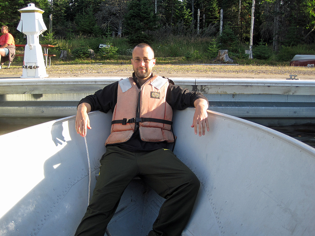
It was our final morning on Isle Royale. We’d be taking the ferry back to Copper Harbor at 2:45 that afternoon. First thing, Adam went down to the dock to see if they were letting people rent motorboats that day.
They were, so Adam and Phil made the arrangements while Sean and I got a breakfast table at the Grill. Afterward, we donned our life jackets and headed out into Rock Harbor, just before the Ranger III set sail.
We had set our alarms for 6:30am Monday morning, but we were all awake before that, particularly early riser, Phil, who had scouted out a source of coffee before the rest of us were out of bed.


