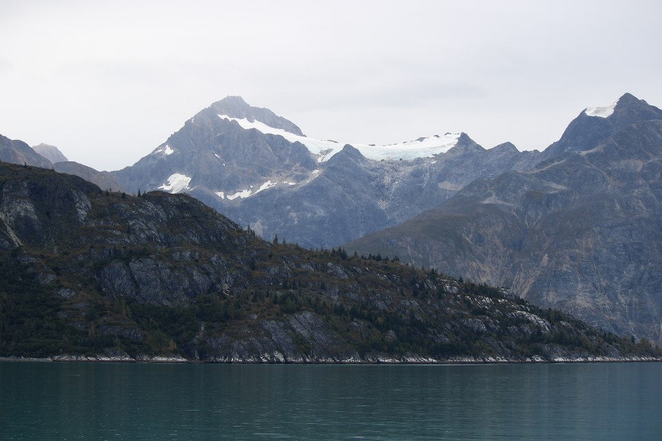
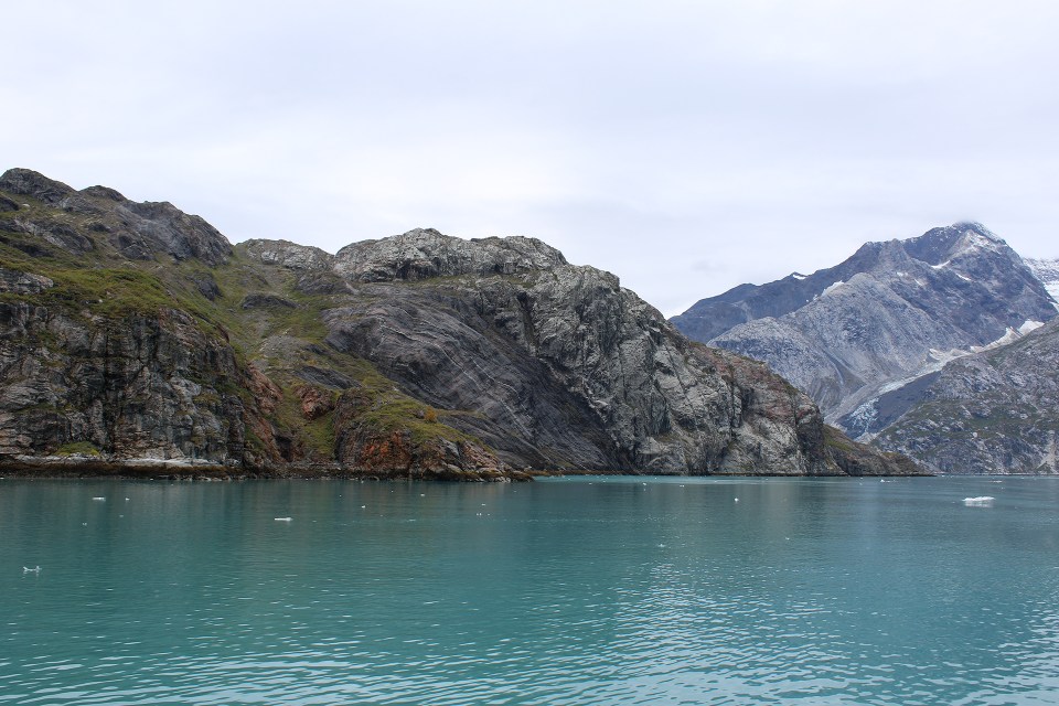
Standing here, with facts so fresh and telling and held up so vividly before us, every seeing observer, not to say geologist, must readily apprehend the earth-sculpturing, landscape-making action of flowing ice. And here, too, one learns that the world, though made, is yet being made; that this is still the morning of creation; that mountains long conceived are now being born, channels traced for coming rivers, basins hollowed for lakes; that moraine soil is being ground and outspread for coming plants,—course boulders and gravel for forests, finer soil for grasses and flowers,—while the finest part of the grist, seen hastening out to sea in the draining streams, is being stored away in darkness and builded particle on particle, cementing and crystalizing, to make the mountains and valleys and plains of other predestined landscapes, to be followed by still others in endless rhythm and beauty.
– John Muir, 1879, from Travels in Alaska, published posthumously in 1915
Friday, September 4 dawned overcast at Bartlett Cove. We were taking the 7:30 am boat tour of Glacier Bay, which lasted eight hours and traveled 146 miles roundtrip from the dock at Bartlett Cove, up into the end of the Bay’s West Arm and back again.

Our course, captured by my GPS device.
Many of our companions during our four days at Glacier Bay Lodge had taken the boat tour the previous day when it had been sunny and warm. The overcast and occasional drizzle that were waiting for us on our tour were in complete contrast to our boat tour of Kenai Fjords National Park two weeks earlier. In truth, I was looking forward to the contrast between that sunny day and a more moody, mysterious atmosphere.
We woke early and breakfasted in the Lodge. Our dining companions, hushed with sleepiness and expectation, were clearly the first shift of diners, and therefore would also comprise the bulk of our companions on the boat. We were slightly chagrined that one aging, entitled couple whom we’d overheard complaining about this and that to the Lodge staff over the previous two days would be on our tour. It was amazing the little things people could find to complain about at an amazing Lodge in a glorious National Park.
Our server at breakfast was an earnest young man named Forrest who was very excited for us that we were going on a tour of the Bay.
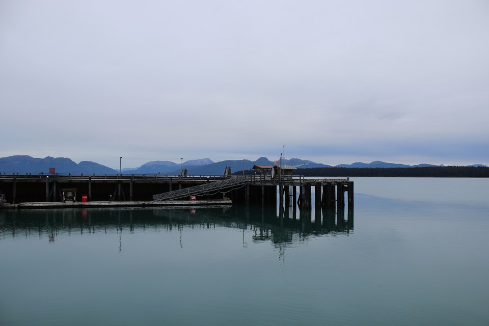
Because of the cloud cover, the Fairweather Range was missing from the now-familiar view of Bartlett Cove from the deck of Glacier Bay Lodge.
After we ate, we gathered our day packs and headed down to the dock. The temperature was in the forties at about a quarter past seven, but it wasn’t raining, so it wasn’t bad. The clouds added a soft layer to the atmosphere, contributing to a sense of calm and hush and gentle expectation.
Our tour was aboard the Baranof Wind, operated by park concessionaire, Doyon Aramark.
We chose seats on the starboard side of the boat because of a tip from some guests at the Lodge. I suppose it needn’t have mattered, really, since we didn’t spend much of the eight hours in our seats.
Soon we were underway on the still waters of Bartlett Cove. Despite its being overcast, the Cove was as serene as it had been during our paddle the day before.
We headed southwest out of Bartlett Cove, then rounded Lester Island and turned northwest into the Sitakaday Narrows section of lower Glacier Bay.
To starboard were the rugged peaks of the Beartrack Mountains.
To port were Whitecap Mountain and the western shoreline of Glacier Bay.
And behind us to the east/southeast a soft tangerine morning glow lit the sky beyond Bartlett Cove, where the area around the Visitor Center was a speck of civilization amid 3.2 million acres of wilderness.
As we turned north toward the center of the lower portion of the bay, our first destination was a tiny island far in the distance.
Unlike at Kenai Fjords, our tour was narrated by a National Park Ranger, who seemed as excited to be going “up bay” as we were.
As the shoreline flowed past on either side of the boat, inlets, channels, and islands beckoned. The scale was phenomenal.
Then, far off in the distance on our port side, we spotted a huge cruise ship, utterly dwarfed by the scale of Glacier Bay. It only reinforced the enormity of the landscape. Although it was fun to see the ship in the distance, part of the reason we had chosen Friday instead of Thursday for our Glacier Bay tour was because there was only one cruise ship scheduled to be in the Bay that day instead of two.
And then we reached our first destination, South Marble Island near the middle of the center of the lower portion of the bay.
South Marble Island and the low islets off its shore are favorite haul out sites for Steller’s Sea Lions.
There were dozens upon dozens of Sea Lions, young and old, large and small, ranging from light brown to a deep gray. They were smelly and noisy and their cacophony was completed by the screams of Glaucous-Winged Gulls and Black-Legged Kittiwakes.
Video: Sean M. Santos and Brandon Hayes
South Marble Island is also a haven for nesting seabirds, with colonies of Black-Legged Kittiwakes, Glaucous-Winged Gulls, Pelagic Cormorants, Common Murres, Horned Puffins, and Tufted Puffins.
The light rain that had started before we reached South Marble Island became more insistent as we departed, so Sean and I went below deck and sat for a while near the windowed bow.
But soon I was back up on deck capturing more images.
About halfway up Glacier Bay from Icy Strait, the bay splits into two major inlets, Muir Inlet to the northeast and the West Arm to the northwest. Two-hundred years ago, one massive glacier, the Grand Pacific, filled the entire Bay all the way into Icy Strait. What are today the two main inlets were then the two main feeder glaciers of this absolutely enormous glacier.
By the time John Muir visited Glacier Bay in 1879, the main glacier had retreated and split into two large glaciers. Muir Glacier filled Muir inlet all the way to the main Bay. Grand Pacific Glacier extended much farther down the West Arm than it does today.
Glacier Bay is undoubtedly young as yet. [British Admiral George] Vancouver’s chart, made only a century ago, shows no trace of it, though found admirably faithful in general…[Muir’s Tlingit companion] Charley, who was here when a boy, said that the place had so changed that he hardly recognized it, so many new islands had been born in the mean time and so much ice had vanished. As we have seen, this Icy Bay is still farther extended by the recession of the glaciers. That this whole system of fjords and channels was added to the domain of the sea by glacial actions is to my mind certain.
– John Muir, 1879, from Travels in Alaska, published posthumously in 1915

Tlingit Point
Tlingit Point is the demarcation between Muir Inlet and the West Arm of the Bay. We went close to shore here to ensure that there were no kayakers or campers who needed to be picked up. Although none were scheduled, the tour boats always check two of the drop off points to be certain.
We continued northwest up the West Arm of Glacier Bay. As we went, we hugged the eastern shoreline, which here was a rugged, forested coast.
High up on an unnamed peak we spotted six Mountain Goats.
We turned right and entered Tidal Inlet to look for wildlife and were rewarded with a flock of Surf Scoters.
After Tidal Inlet, we continued along and approached Gloomy Knob, or Jánwu Aaní, which means “Mountain Goat Land” in Hoonah Tlingit.
The Tlingit name is apt.
We had searched the surrounding mountains in vain for Mountain Goats at Exit Glacier in Kenai Fjords National Park, we’d seen them as tiny specks high on Mount Juneau, and we’d seen a few very high up already that morning in Glacier Bay.
But as we rounded the front of Gloomy Knob, there were a dozen of them, most only 100 or 150 feet up the side of Gloomy Knob. It was fantastic!
West Arm widened beyond Gloomy Knob. We spotted a Humpback Whale, but I didn’t manage to snap a photo. Two inlets branched off to starboard from the West Arm. Each contained a glacier, which once would have been a tributary of the Grand Pacific Glacier.
It was around this time that they served lunch, and Sean continued to eat his body weight in clam chowder.
The boat was not full, but there were some interesting fellow passengers, including a group of five scientists, all women, laughing and talking together; a woman most aptly described as a trophy wife who kept taking selfies; some international tourists; and a clutch of Park staff who were going up bay one last time before the season ended.
Opposite Russell Island, which had been half encased by Grand Pacific Glacier when John Muir first visited Glacier Bay, we spotted three Brown Bears hunting salmon on the tidal plain.
In the image above, the bear in the middle, which appears to be a juvenile, has a salmon in its mouth.
From their size, these bears appear to be a family group of a mother (center in the image above) and two yearling cubs that would have already spent a winter with her.
Past Russell Island, we entered Tarr Inlet, the farthest northwest extent of Glacier Bay.
The waters of Tarr Inlet were littered with small icebergs, called bergy bits (1-4 meters above the water) and growlers (1 meter or less above the water). The waters were a brilliant turquoise because of the glacial silt suspended in them. The silty deposits from pulverized rock, carried to Tarr Inlet by glaciers, reflects the color spectrum in such a way as to cause the striking turquoise.
Video: Sean M. Santos
At the end of Tarr Inlet is what remains of Grand Pacific Glacier, the behemoth that advanced cataclysmically during the Little Ice Age destroying the lush valley that had once been home to the Hoonah Tlingit. This was the glacier that created Glacier Bay, extending one hundred miles from its origins on the slopes of Mount Fairweather all the way into Icy Strait. Today, it is twenty-five miles long and does not quite reach Tarr Inlet, stopped by its own terminal moraine, the deposit of rock and silt built up at its snout.

Margerie Glacier (left) and Grand Pacific Glacier (right)
Grand Pacific Glacier is not the only glacier at the head of Tarr Inlet. It sits to the right of Margerie Glacier, a gorgeous tidewater glacier descending from Mount Quincy Adams in the Fairweather Range.
Grand Pacific Glacier, despite its staggering retreat, has advanced since 1925. Then, its terminus was in Canada. Today it has pushed forward and is just barely within the United States. The border between Alaska and British Columbia is just behind the snout of Grand Pacific Glacier.
Despite its advance during the twentieth century, Grand Pacific is a dying glacier. It is thinning out in height and width. It is also a very “dirty” glacier, nearly covered at its snout with rock and silt. Despite its awesome power and its history of carving Glacier Bay, Grand Pacific is wholly outmatched by Margerie, its gorgeous companion, in terms of beauty.
Climate change offers nothing but uncertainties for Grand Pacific Glacier. It is possible that warming temperatures will continue to cause Grand Pacific to waste away. It is also possible that warmer, moister air in the Pacific will cause a substantial increase in precipitation in the Fairweathers. If that is the case, and assuming that the precipitation is in the form of snow, it could supercharge Grand Pacific, causing it to surge forward yet again. We know that Glacier Bay and its glaciers have gone through many cycles of advance and retreat. What climate change will do to alter these cycles is yet to be seen.
And then there’s Margerie Glacier, among the most famous and most beautiful on the planet. Margerie in one glance embodies everything that a tidewater glacier should be in one’s imagination: a sinewy and visible advance from snow-covered peaks, a gorgeous pale-blue hue, lofty seracs (towers of ice) at its snout, and icebergs actively calving from it.
Margerie Glacier is twenty-one miles long. At its terminus, it is a mile wide and rises some 250 feet above Tarr Inlet in a wall of towers, arches, and rippled crevasses.
Poor Grand Pacific Glacier. It was difficult to tear our eyes from Margerie…particularly as we were waiting to see and hear her calve an iceberg…to appreciate his dirty snout, which truly is fascinating in its own right.

Mount Forde, immediately northwest of Margerie Glacier in British Columbia’s Tatshenshini-Alsek Provincial Park
Margerie calved a few small bergs in the half hour or so we spent with her, but nothing particularly massive. And nothing from beneath the water’s surface.
Eventually, the cruise ship we were sharing Glacier Bay with on that day approached up Tarr Inlet. Powered by the ship’s facilities, we suddenly had cell service in the midst of this wilderness.
It was time to leave Margerie and Grand Pacific Glaciers and begin our return to Bartlett Cove, some seventy miles away. The cruise ship made its approach to Margerie. That she towered over it reinforced how massive she and her surrounding landscape are.
We made our way southeast out of Tarr Inlet and turned right into Johns Hopkins Inlet. In this far up bay landscape, there were no forests. It is often remarked that a trip up Glacier Bay is a trip back in time to the last Ice Age, and that was the point we had now reached.
Glacier Bay affords a remarkable opportunity to study the succession of plants as their communities establish themselves, evolve, change, and grow larger and more robust, providing habitat for an array of wildlife. In the immediate aftermath of a retreating glacier, lichens begin to break down the bare rock into small pockets of loose soil. Then the first small plants and flowers take root, stabilizing the soil and beginning the process of enriching it with nutrients and organic materials.
Eventually, shrubs and small trees like dwarf willow and alder establish themselves. In time these are replaced by larger trees and tall conifers as the forest reaches maturity. In Glacier Bay National Park, judging by the time of glacial retreat in recorded history, this process takes about one hundred years to complete.
In Johns Hopkins Inlet, we turned left for a view of Johns Hopkins Glacier, which extends twelve miles from the Fairweathers. Johns Hopkins is one of the only glaciers in the Park that is advancing. As it advances, it robustly calves icebergs, making it a haven for Harbor Seals rearing their pups. Because of that, nautical approaches to the glacier are forbidden.
Johns Hopkins is another gorgeous tidewater glacier, robust and deeply striped with medial moraines where it carries the Fairweathers to the sea.
Near the entrance to Johns Hopkins Inlet, on its southern shore, we encountered Lamplugh Glacier, which descends sixteen miles from the Brady Icefield in the southern Fairweathers. At low tide, the the Lamplugh doesn’t quite reach the sea, at high tide it does.
As beautiful as Margerie Glacier is, I think that Lamplugh Glacier is my favorite of all the glaciers we saw in Alaska. There is just something about the way it sits within its surroundings that just feels right. It isn’t an imposing glacier, nor is it unusually striking, nor does it feature rare formations. It’s just lovely, and I like it quite a lot.
As we exited Johns Hopkins Inlet and made our way southeast along the western shore of Glacier Bay, we noticed that the shrubs and alders along the shore were beginning to sport their autumn colors.
Along the shore southeast of Lamplugh Glacier, we spotted our second trio of Brown Bears. They were hanging out on a moraine near the water. Again this appeared to be a mother and two cubs, but these cubs were larger. Likely they were second year cubs, approaching their mother’s size.
While we were watching the bears, a Bald Eagle flew by. It literally flew through the frame of some of my shots of the bears. It was certainly an Alaska moment…
The final glacier we visited in Glacier Bay…or in Alaska for that matter…was Reid Glacier, which, like Lamplugh, also extends from the Brady Icefield. It stretches ten miles from the icefield and stops just short of the water. Another beautiful glacier, it is memorable for its intricate surface patterns.
From here, we picked up the pace a bit as we continued along the western shore.
All the way down bay the waters appeared tranquil in spite of the occasional spits of rain.
We entered Blue Mouse Cove to do our second check for campers and kayakers, but we didn’t see a soul.
Near Geikie Inlet, we began to see Sea Otters, dozens of Sea Otters.
We passed Geikie Inlet and entered the Whidbey Passage between the western shore of the Bay and three islands. The passage was a haven for Sea Otters. Every time we passed one, we looked forward and saw another. We weren’t counting, but we likely saw three dozen in this final leg of our tour.
After we exited Whidbey Passage, the Bay became choppier, but we kept seeing Sea Otters. The somewhat excitable German couple sitting in front of us exclaimed every time they spotted one. I kept stepping outside for yet another attempt at the perfect Sea Otter shot.
And I got it.
As we approached Bartlett Cove, the Ranger pointed out a small vessel off our port side. It was the Humpback Whale study boat out doing its daily count.

The bridge of the Baranof Wind
Soon we were in sight of the dock, and our tour had come to an end.
After we’d gathered our things and disembarked, we headed to the Lodge. It was not yet four, and we were ready for a snack. Stefania was our server again, and after she’d brought us our nachos and beer, we chatted for a bit. She had worked at multiple National Parks across the country. She loved it and intended to do another next season. We chatted a bit about the food scene in Juneau. She raved about the Rookery, as had our paddling guide Brittney. We hadn’t been too impressed with our lunch there, but decided we would try it again for dinner the next night, which would be our final night in Alaska.
That evening’s talk in the Visitor Center was given by Ranger Brian Whitehead. It was on John Muir and his love of and fight for wild places. Ranger Brian’s talk was very personal. His journey with the National Park Service had begun as a volunteer at Yosemite National Park, and now, like Muir, he shared a deep love and knowledge of both that Park and Glacier Bay National Park. It was a splendid, heartfelt talk.
After the talk, we had our final dinner at Glacier Bay Lodge. We had Amy as our server again. At the end of the meal, she came over with cheesecake on the house. She said that word had gotten around that we were on our honeymoon and the staff wanted to offer a small congratulations.
We ended a relaxing evening in front of the fire, writing our final postcards from Alaska.
That night, since it had been so overcast, I did not get up every hour on the hour to try and glimpse the Northern Lights. Instead I slept and dreamed of Glacier Bay.


